Dear Kit Carson Electric Members,
The National Weather Service has issued a High Wind Warning for Friday, February 20, from 9:00 AM to 5:00 PM MST affecting portions of our service territory, including:
- Eagle Nest
- Angel Fire
- Ute Park
- Black Lake
- Communities east of Rock Wall on NM 518While the current warning area does not include Red River, our internal weather monitoring indicates the potential for strong gusts near Red River as well. Members in all northern service areas should remain alert and prepared.
Forecast Conditions:
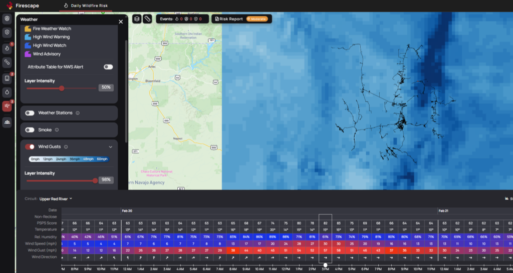
West winds of 35 to 45 mph with gusts up to 60 mph are expected.
Potential Impacts:
- Downed trees and power lines
- Possible power outages
- Difficult travel conditions, especially for high-profile vehicles
- Hazardous crosswinds on north–south roadways
How to Prepare:
- Secure outdoor furniture, trash bins, and loose materials
- Charge phones and essential devices
- Prepare flashlights and backup power sources if available
- Avoid unnecessary travel during peak wind hours
Kit Carson Electric crews are monitoring conditions closely and are prepared to respond as needed. If you experience an outage, please report it immediately through our outage reporting system or by calling our office.
We appreciate your cooperation and encourage everyone to prioritize safety during this wind event.
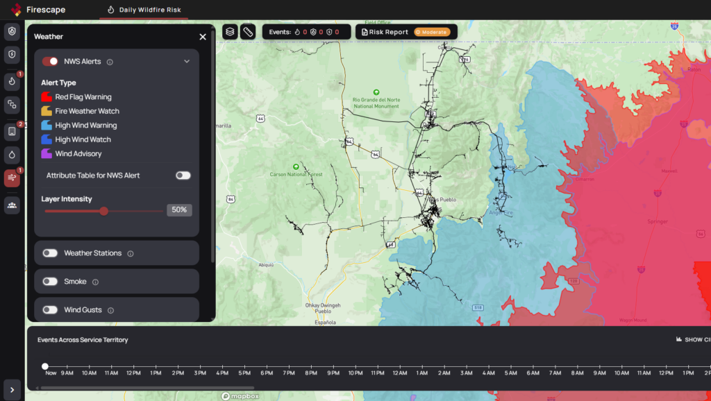
National Weather Service Warnings Affecting 1 HFRA
Detailed maps and information found at app.firescape.ai.
High Wind Warning
 Impacting: Pilot Region East
 Effective: from February 20 at 09:00 AM to February 20 at 05:00 PM MST
 Last updated: February 19 at 11:36 AM MST
 Impacts: Damaging winds could blow down trees and power lines. Power outages are possible. Travel will be difficult, especially for high profile vehicles.
 Description:* WHAT…West winds 35 to 45 mph with gusts up to 60 mph expected. * WHERE…East Slopes Sangre de Cristo Mountains, Southern Sangre de Cristo Mountains, Eastern San Miguel County, and Northeast Highlands. * WHEN…From 9 AM to 5 PM MST Friday. * IMPACTS…Damaging winds could blow down trees and power lines. Power outages are possible. Travel will be difficult, especially for high profile vehicles. * ADDITIONAL DETAILS…Difficult to dangerous crosswinds are expected on north-to-south oriented roadways such as I-25 near Las Vegas.